 Middleborough to Mount Carmel (East Middleborough)
  Mount Carmel (East Middleborough) to Darby
 Darby to Plymouth
.
Illustration:
Maps created by Michael J. Maddigan, October, 2009, utilizing Google Earth.
Writing About the History of Middleborough & Lakeville, Massachusetts
Middleborough to Mount Carmel (East Middleborough) Mount Carmel (East Middleborough) to Darby Darby to Plymouth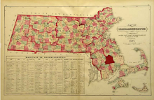


Eddyville, Middleboro, Massachusetts: 1661-1987. Middleborough, MA: The Eddy Homestead Association, 1988.
LAKEVILLE
Lakeville "Center" and Assawompsett Neck
The Lakeville Historical Tour Committee Presents Dartmouth Path - The Old Stage Road. Lakeville, MA: Preserve Our Lakeville Landmarks, 2001.
The Lakeville Historical Tour Committee Presents Old Main Street and Crooked Lane & A Self-Guided Tour of Main Street. Lakeville, MA: Preserve Our Lakeville Landmarks, 2003.
Michael J. Maddigan. Lakeville's King Philip Tavern: An Illustrated History. Lakeville, MA: Preserve Our Lakeville Landmarks, 2010.
Beechwoods
The Lakeville Historical Tour Committee Presents Historic Pierce Avenue. Lakeville, MA: Preserve Our Lakeville Landmarks, 2001.
Kenneth C. Leonard, Jr. The Beechwoods Confederacy 1709-1809: The Colonial History of Beechwoods Middleboro-Taunton Precinct, Massachusetts. Bowie, MD: Heritage Books, 2003.


+of+Smoky+Mountains+018.jpg)

1 comments:
I lived along this old rail bed in two places. Twenty Lothrop Street where the rails were still in place when I walked along them to the old Cold Spring School. The bridge over Court Street was gone then in 1948 but the rails went up to Court Street. We moved to the Housing project on 30 Olmstead Terrace. The rails were gone but the bed went right past the project across Standish Avenue and out past Rt 3 and to Rt. 80. The railing of the old bridge is still standing on Standish Avenue. I think they just filled in the bridge and build the road on top of it.
John Barlow
Post a Comment