Showing posts with label Nemasket River. Show all posts

Wednesday, July 17, 2013

Lyon's Neck

The most dramatic feature of the landscape along the northern portion of the Nemasket River at Purchade is the unique ox-bow bend made by the sharp turning of the river which flows northwards, then southwestwards, then southeastwards where it comes within some 350 feet of doubling back upon itself before finally turning westwards towards its confluence with the Taunton River. In the process, the river circumscribes a 22 acre triangular-shaped parcel of upland fringed with swampy ground.


The land defined within this ox-bow bend is historically known as Lyon’s Neck, four generations of the Lyon family having owned land there from about 1730 through 1821. The comprehensive Lyon Memorial genealogy in 1905 noted the long association between the family and Lyon’s Neck, remarking “traditions of the ‘Ox-bow’ linger still among the descendants of Samuel [Lyon]”, the original settler. Sadly, the editors of the volume do not elaborate on what those traditions were, though they were no doubt rooted in the family’s unusual geographic situation, a large portion of their land being nearly surrounded by the Nemasket.

Little is known of the pre-Contact history of Lyon’s Neck. According to Maurice Robbins’s 1973 map Middleboro Purchases, the area between the Nemasket River and Purchade Brook (including Lyon’s Neck) was known to the Native peoples as Tepikamicut. This land was included as part of the Purchade Purchase, the second purchase made from the Native peoples in Middleborough. Completed in 1662, the Purchade Purchase was subsequently divided into lots running perpendicularly to the Nemasket River with the area of Lyon’s Neck being set off as the fourth lot to Peregrine White (1620-1704), the first known English child born in America.

Though the area Lyon’s Neck is today fairly remote, uncrossed by roadways other than old woods roads, in the early 17th and early 18th centuries, it was visited more regularly. A 1742 deed makes note of the remains of an “old house” situated near the Nemasket River on what was probably the adjoining third lot of the Purchade Purchase as well as a “way [that] goes down the bank [of the river] to the old fishing stage or fishing place”, indicating the close connection between the first settlers and the Nemasket River which served as both a transportation route and a source of fish.

The fourth lot of the Purchade Purchase passed through a number of hands until late 1730 when the northernmost 70 acres came into the possession of Samuel Lyon (1679-1756) of Roxbury, Massachusetts, who purchased the property from Benjamin White of Middleborough for £545. Notably the 1730 title deed records the boundary as following the Nemasket River “ down stream round the Neck”. Lyon removed to Middleborough and was settled enough to join the First Church of Middleborough on January 23, 1732, constructing a house about one-third of a mile south of the neck in an area of meadows.

Over time the division line between the third and fourth lots of the Purchade Purchase became lost and by 1742 the owners were “uncertain where they stood”. Consequently, Samuel Lyon as the owner of the northern portion of the fourth lot, Lyon’s in-law Thomas Knowlton as owner of the southern portion of the fourth lot, and David Miller as the owner of the third lot agreed to establish a line delineating their parcels “so that all disputes and controversies concerning the bounds and line between the two …. Lots of land may be ended.”

On March 16, 1750, Samuel deeded his 70 acre farm at "Purchade Neck, Middleboro (the ‘ox-bow’)" to his son, Jedediah Lyon (1721 - 1807), for £100. The deeded land included the entire 22 acres on Lyons Neck, another 20¾ acres of woodland immediately to the south, 18½ acres of cleared land south of the wooded tract that was the site of the Lyon homestead and was later set off as a dower lot for Vinal Lyon’s widow Chloe (Richmond) Lyon, and still further south several acres of swampland in what was known as Lyon or Lyon’s Swamp.

The lands at the neck were an important part of the homestead farm of Jedediah Lyon whose grandson Isaac Lyon noted that the portion of the farm lying along the Nemasket “was known by [name as] the neck” with the western portion (the furthest downstream) being known as the “lower neck” and the eastern portion further upstream as the “upper neck”. Though the use to which the neck may have been put is not recorded, it is possible that it was used as pasturage for cattle, the nearly complete circuit of the river forming a natural barrier to keep cattle from straying. There is a record dating from 1821 of a fence running across at least the eastern portion of the neck down to the river, giving credence to the thought that the neck was used for livestock.

One of the earliest if not the first recorded appearances of the name “Lyon’s Neck” is in a deed written in 1825 indicating that the feature was clearly known by this name at the start of the 19th century, if not earlier. By 1904, the name had become well known enough that in the valuation list of Middleborough properties that year, the land at the neck then owned by Earl H. Cushman of Bridgewater could be listed simply as “Lyons Neck Lot”.

With the decline of the Nemasket as a transportation route, access was provided to the neck by woods roads. When Samuel Lyon purchased the property in 1730, he also acquired the right to use “a cart way from said tongue meadow unto the highway that leads to the causey [causeway] called Samuel Eaton’s causey.” In 1821 when the upper neck was sold to Solomon Alden of Bridgewater, Alden was granted “the privilege of going with the team from the highway to and from said lot through gates and bars…”. Later U. S. G. S. survey maps indicate a roadway that connected the neck with Murdock Street, though the original approach may have been from Plymouth Street near White’s Hill.

The distinctiveness of the Nemasket ox-bow at Purchade notwithstanding, it does not appear on maps until 1855 when it is clearly depicted on Walling’s map of Middleborough of that year. Despite the inclusion of Lyon’s Neck on the map, Walling misidentified it, labeling instead as Lyon’s Neck the area on the opposite bank of the river.

The neck remained in the possession of the Lyon family until the first quarter of the 19th century. In 1810, Isaac Lyon, Samuel Lyon’s grandson, sold the westernmost 10 acres or lower neck to Captain Nathaniel Bump/Bumpus of Middleborough. Fifteen years later in 1825, Seth Eaton, Jr., administrator of the estate of Vinal Lyon (1762-1819), Jedediah’s son, sold the remaining acres at the upper neck to Solomon Alden of Bridgewater. Since that time, Lyon’s Neck has largely been abandoned. Tracts to the south and southeast were utilized well into the 20th century as woodlots including lands later owned by Ezra Morse and jointly by Luther B. and Silas H. Murdock.

Illustrations:

Map of Lyon's Neck, Middleborough, MA.  
The base map is U. S. G. S. survey map, Bridgewater Quadrangle, 1940.

Facsimile of Samuel Lyon's Signature from the Lyon Memorial (1905).

Samuel Lyon Grave Stone, Purchade Cemetery, Middleborough, MA.
The image first appeared in the Lyon Memorial (1905).   

Sources:

Kinnicutt, Lincoln Newton. Indian Names of places in Middleborough, Lakeville and Carver, Plymouth County, Massachusetts, with Interpretations of Some of Them. 1909.
Lyons, A. B. and G. W. A. Lyon, eds., Lyon Memorial. Detroit: privately published, 1905.
Plymouth County Registry of Deeds 29:41, 35:36, 41:64, 115:124, 144:200, 155:104, 296:241.
Robbins, Maurice. Middleboro Purchases. 1973.
U. S. G. S. survey maps, Bridgewtaer Quadrangle, 1940, 1962, 1977.
Walling, H. F. Map of the Town of Middleborough, Plymouth County, Mass. 1855.
Walling, H. F. Map of the County of Plymouth, Massachusetts. New York: D. R. Smith & Co., 1857.

Tuesday, August 2, 2011

The Ocean House Demolished, 1910

"Ocean House" with Middleborough Municipal
Electric Light Plant, Wareham Street,
Middleborough, MA, photograph, c. 1900.
Located on the west shore of the mill pond at Wareham Street was once a ramshackle building known around 1900 as the “Ocean House”, possibly as a satiric barb aimed at seaside luxury resort hotels of the era. For lower class Middleborough children, this was their oceanside alternative. The Ocean House which had originally been associated with the industrial works on the river nearby proved popular with local children who would dive from its open windows into the mill pond below. This activity ended, however, following the tragic 1905 death of six year old Wallace Spooner who while engaged in diving from the building struck his head upon a stone wall, fell into the river and drowned. Nothing, however, was done with the property until 1908 when the Middleborough Board of Health condemned the structure which was demolished two years later in spring of 1910.

The “Ocean house,” a blot on the landscape by the river side for many years, is no more, and all the lumber has been cleaned up. The beneficial change which has resulted would well repay one a trip to the Wareham street bridge. All the old tumble-down structures are now out of the way, and the appearance in that locality is materially improved.

Sunday, April 25, 2010

Puffs from the Steamboat, 1877

The following poem was written by a man named Fish on the occasion of the construction of John Baylies LeBaron's steam boat Pioneer.

The grand achievements of noble men
Deserve the homage of voice and pen
Their hidden thoughts like diamonds bright
Astonish the world when they come to light.
We need not go to a foreign shore
To find such men at your very door.
They daily pass with a busy brain
Building something and not in vain.
Next to the Creator, man
Fulfills his part of the infinite plan.
Little by little along life's road
Every good deed, is a prayer to God.
Who would have tho't fifty years ago
This town would ever be built up so
Or any old settler, dared to dream
Old Nevertouch Pond would be sailed by steam.
Nemasket crooks, and bridges too,
How a steamboat's funnel poking through,
Or the beautiful Lake a thing so fine
As a male and female steamboat line.
Some folks laughed and gave a sneer
At the mad idea of a steamboat here,
Saying - the rocks she'll never clear
Nor the narrows either, you might as soon
Undertake a voyage to the moon
On a foggy night in a steam spittoon.
But it seems somebody understood
His business well, as others should.
For the town forked 700 over
To make improvement in the river.
All of the Lakeville points of law
Weighed in the balance, less than straw,
Were argued a little just for fun
By votes unanimous, all but one.
And the following day the work began
At Harlow's Mill the stuff was planed
And dried by steam whene'er it rained.
On the gently sloping western side
Of Nevertouch, where the billows glide
The keel was laid, with ease and skill
July 19th this proving still
There's a way, whenever there's a will.
And every day the people go
To the boat, as they would to Barnum's show
And not a few are inclined to say
I guess after all, the thing will pay.
Men of science, and ladies fair
Foreigners with distinguished air,
Lame, halt, and blind, and out of repair
Say! Where is the steamboat, oh! tell us! Where?
Most every body is wide awake
For a greater commerce on the Lake
And very likely within a year
An hundred souls may be running here.
There'll be no need of travelling round
To Saratoga and Vineyard Sound
In quest of high toned rustication
But take the quickest transportation
By river steamer at moderate price
For the pleasure seekers' paradise
Of picnics, clambakes, fancy balls,
Hotels, saloons, and fested halls.
Bazaars, and palaces, and bowers
Wherein to woo the rosy hours.
In the great lake city, sure to grow
For all the Second Advents' know.


Illustration:
"Steamer Pioneer", adapted from "Natchez Steamboat", photograph by
David Paul Ohmer, November 12, 2008, used under a Creative Commons license.

Friday, April 23, 2010

Nemasket Steamboats, 1877-95


Won’t it be fun to hear the boat’s whistle blow and see people hurrying with carpet bags, valises, trunks, etc.
Middleboro Gazette, July, 1877


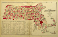
The Upper Factory mill pond, the pond which is formed by the damming of the Nemasket River at Wareham Street, was once the site of Riverside Wharf, the embarkation point of Pioneer and Assawampsett, two small steam-powered side paddle boats which were operated as excursion craft in the last quarter of the century by owner John Baylies LeBaron (1845-1918).

When LeBaron first proposed the construction of a steamer to ply the Nemasket River, he had to address the matter of the three road bridges above Wareham Street. Waterman’s Hill Bridge (Grove Street), Alms House Bridge (Wood Street) and Vaughan’s Bridge (Vaughan Street) were all of low height and unaltered would restrict the passage of any steamboat underneath. At LeBaron’s request, Middleborough established a Bridge Committee comprised of A. C. Wood, J. G. Vaughan and J. H. Shaw to consider the matter. The committee reported favorably, and the town expended just over $900 to raise the bridges. Of this amount, $550 was paid to Samuel Clark, John Carver and Edgar Thomas for the work (exclusive of materials); $55.50 was paid for the services of the committee; $103.19 to Vaughan for lumber for the Waterman’s Hill Bridge and additional work on all three; $29.75 to Wood for additional work on Alms House and Vaughan’s Bridges; and $14.00 to B. P. W. Lovell for extra work on Vaughan’s Bridge. The balance, presumably, was spent on material.

It is likely that the town was motivated to expend the funds for the promotion of a strictly private enterprise by the prospect of Lake Assawompsett’s development as a local resort:

Picnic parties are all the rage now, from the village to the borders of these beautiful lakes, which we hope a recent act of the town meeting in voting to raise the river bridges to permit John Baylies LeBaron’s steamboat to pass under, will be made more accessible.

First built of LeBaron’s two steamboats was Pioneer in 1877 with lumber milled at the Ivory Harlow steam mill on Vine Street in Middleborough. Built as a flat-bottomed steamer, the boat had her forty foot keel laid on the bank of Nevertouch Pond on Middleborough’s West Side, and was equipped with a coal-burning upright steam boiler and a driving mechanism designed entirely by LeBaron. The boat was built to accommodate fifty passengers, though later reports reduced the number to forty as the optimal number. Following a successful test on Nevertouch, Pioneer, weighing some 4,500 pounds was hauled overland down Center Street and launched into the river.

Though Pioneer had been built expressly to be operated under LeBaron’s command, problems soon arose when it was required that LeBaron hold a fireman’s license in order to operate the craft. LeBaron, who did not have such a license, argued that since it was he himself who had built the boat and boiler, he certainly had an understanding of how the boat operated. Confronted with this logic, the license was duly granted.

Pioneer enjoyed a brief first season, being removed from the river in October, 1877, by William Downing who hauled the vessel to LeBaron’s yard where it was laid up for the winter. Pioneer was overhauled the following spring, with larger paddle wheels being added, as well as additional planking on the hull. She was repainted at this time, as well, and launched by Downing into the river from Rock Street in May, 1878, at which time the Gazette wrote that “we expect she will give greater satisfaction this season.”

In the spring of 1879, the boat was once again overhauled, refitted and repainted. The Old Colony Memorial reported in June of that year that Pioneer “has commenced making her regular trips to the lakes, and has had several excursion parties. Captain LeBaron is a first class hand for a ‘time,’ sparing no pains to please his patrons.”

An 1879 advertisement for Pioneer (which was later described as “very safe, though slow”) provides a wonderful prospectus of the typical trip on the river. Pioneer departed Riverside Wharf at one p. m. each Tuesday, Thursday and Saturday, to cruise the Nemasket River and Lake Assawompsett. Once on Assawompsett, the boat would touch at Stony Point (Nelson’s) Grove before crossing the lake and passing through the Narrows into Pocksha Pond. The return journey would stop at Sear’s Grove before arriving back at Middleborough at four p. m. The three hour round trip covered seventy miles and cost fifty cents. Moonlight excursions were conducted every month and “societies, families and Private parties [were] accommodated any of the remaining days of the week at reasonable rates.”

Despite the promise of a successful third season on the river, Pioneer was temporarily disabled when soon after these reports she broke her shaft in June, 1879, putting her out of commission until mid-August. LeBaron believed the accident was due to an undetected crack in the shaft which occurred in July, 1878, “when her paddles became locked in the river grass and her gearing broke….”

Two years after her construction, Pioneer was joined – and later replaced – by Assawampsett. Built in 1879, Assawampsett was a sixty-four foot long craft, alleged to be capable of carrying one hundred passengers and an orchestra. E. T. P. Jenks, in 1943, affirmed that indeed the boat had “carried a load of forty or fifty people on the regular excursion to the lakes, three times a week and … on special occasions carried as many as a hundred or more.”

The boat had a flat bottom with a shallow draft which enabled it to pass over obstructions in the river with relative ease. The coal-fired boiler built by Lebaron was vented by an adjustable smokestack which could be lowered to allow clearance beneath the bridges upstream. Some accounts indicate that the smoke stack “was hinged and as the ship neared the bridges, a crewman went on the top deck and laid it flat, until the bridge was passed. Then it was raised again.” Other records indicate a different design for the smoke stack:

To allow for the boat’s getting under [the bridges, LeBaron] rigged a recessed smoke stack, which was lowered into a pocket in the top deck, until they cleared the bridge, then it was raised again.

In either case, passengers located on the top deck were required to go below until the bridge had been cleared.

Two men were required to operate the steamers, LeBaron acting as captain and either one of his sons, Elric H. or Jesse acting as fireman fueling the boiler, lowering the smoke stack and performing other tasks as needed. Among these latter duties was the removal of floating logs which had the potential of doing significant damage to the paddle wheels. On these occasions, the engine was cut and Elric LeBaron, “equipped with a saw, would crawl alongside the wheel and saw the log in two. The boat meanwhile was drifting down stream, but when power was again applied, that was made up, and the upstream trip was resumed.”

A “settin’ pole” was used to maneuver the craft off rocks and shoals, as well as to navigate tight bends along the middle portion of the route. At these spots, the engine was again stopped and the vessel powered and guided by means of the pole. Enabling the steamers to pass up river was a canal which had been cut just north of Vaughan Street in 1816. Initially intended to increase the flow of water to mills located further downstream, the canal “straightened the steamer path. It was a shortcut around a river bend of such small axis that the steamer could not make the curves.”

Occasionally, the steamboat excursions were marred by difficulty. Sometime in the 1880s while on a Fourth of July excursion, “the steamer met with an accident, losing part of her smoke stack, which caused some delay. A bolt was also lost, which delayed the passage, and the passengers were not landed until about half past one o’clock.” A similarly fated excursion arranged by E. T. P. Jenks and Fred Holmes set forth on a moonlit night but ended disastrously when the ship grounded on a rock at the foot of Rock Street. Disembarkation for the worn passengers was delayed until nearly dawn.

The steamers were highly popular with local residents, particularly during summer holidays when river outings were made to social events on the shores of the lakes, including the numerous picnics and regattas once held there. Personal recollections which survive nearly all speak highly of the delights of the river steamers, including at least one happy meeting aboard the boat:

Capt. Ezra Pickens of Foxboro, while on a visit to Middleboro, took a trip up the river in a little steamer, and on the way pointed out to a friend the place where he lived and worked as a boy. On remarking that a girl who lived there used to ride a horse at work, a lady near by interrupted the conversation to say that she was the girl. Upon this the old acquaintance was very happily renewed.

Children in the neighborhood of Wareham Street also were fond of the steamboats as they were frequently given free passage between Wareham and Grove Streets through the generosity of LeBaron.

Mr. LeBaron was a kindly man, and after he had delivered a party of passengers from a trip to the lake at the wharf at Wareham street, he always invited all the “young fry” within sound of his voice to “have a ride” as he took the ship upstream to its regular mooring berth near the so-called Japan bridge [at Grove Street].

There were always plenty of kids to go along on the slow trip up river, against the current, and that slow ride probably repaid them amply as they ambled afoot back to their home across the fields from what is now route 28 to the Wareham street section.

Though LeBaron is credited with “the distinction of being the first, and only, man to navigate a steamboat up the Nemasket River”, such was not the case. In 1857, Dr. Ebenezer W. Drake and Robert S. Capen were owners of a 28 foot boat, Namasket which had a capacity of twenty. The boat made trips down the river to Assawompsett, including a journey for a clambake in August, 1857, which was documented in the Namasket Gazette at the time. It is not clear whether the craft was a steamboat, however. Vigers’ History of the Town of Lakeville also credits William Young as having navigated the Nemasket successfully in a forty foot stern wheel paddle boat built for excursions up the river. Supposedly this boat made two trips up river before being relegated to Long Pond where it remained in use as a pleasure boat.

Young’s boat is likely the same as an unnamed one which was recorded as having been built during the spring of 1882 with a reported capacity of 200 passengers. Though this boat was planned to be in the water by June 20 of that year, it is was not in fact ready until the following spring when the Old Colony Memorial reported that “a new stern wheel steamer is to be put into Assawampsett lake this season, running in the excursion business from Middleboro to the lake…” This steamer was completed about late May, 1883, and had a draft of only eight inches. Its capacity had been downscaled somewhat from the original plans, carrying 150 passengers “comfortably.” In 1885, there is mention of yet another steamer, Nemasket, though this may have been identical with Young’s boat.

The Nemasket passenger steamers were joined by the private steam yacht Lavinia which was owned by Charles S. Stratton (better known as General Tom Thumb) and which was launched on the Nemasket in June, 1883, making “a trial trip which turned out very successful.” Named for Stratton’s wife, Lavinia W. (Bump) Stratton, a Middleborough native, Lavinia had been built three or four years previously in Plymouth and was considered “very fast.”

The popularity of steam boating on the river during the last quarter of the 19th century prompted the Old Colony Memorial to report somewhat tongue-in-cheek:

Middleboro’ is going into navigation quite extensively. Another steamer for the Nemasket River has just been purchased. If she keeps on this way the town will get included in some future river and harbor bill.

Yet despite its growing popularity, steam boating on the Nemasket River was fraught with difficulty. Young’s decision to abandon his boat to Long Pond may have been prompted by navigational difficulties along the river where rocks, small shoals, fluctuating water levels and a prodigious growth of grass often made passage difficult. In the spring of 1883, the Middleboro Gazette was calling “for local action to assist in clearing Nemasket River of rocks and shoals, so as to make steam boating practicable between the town and Assawampsett Lake, a fine sheet of water near by,” arguing that “such an expenditure might prove profitable to the town by attracting excursions to the Lake, the railroad also becoming a sharer in the benefits by increased travel.” The Old Colony Memorial echoed the Gazette’s sentiments, arguing that clearing the river would prove obligatory in the interests of navigation. “With such an interest in navigation, the town will soon have to undertake improvement of [the] Nemasket River.” One who took up this call was Stratton who in early August, 1883, “had intended clearing out the grass and blasting the rocks in the river to make a clear passage to Assawampsett Pond for his steam yacht ‘Lavinia’.” Stratton’s untimely death, however, prevented the plans from being acted upon and no further action seems to have been taken except for in 1885 when a portion of the river was dammed and drained to facilitate the laying of water pipes across the river bed at which time a number of rocks against which the steamer Nemasket had scraped were removed. LeBaron’s boats, with their very shallow draft, remained the only steamers capable of navigating the river with relative ease. Nonetheless, the lush growth of river grass (which was mowed periodically to aid the flow of water to the municipal electric light station) could sometimes hinder the boats’ progress upstream as witnessed by the disabling of Pioneer in 1879.

The romantic days of the Nemasket steamers continued until 1895 when the City of Taunton erected its gatehouse at the head of the river, appreciably lowering the level of water in the Nemasket and denying the steamers sufficient draft, as well as barring access to the scenic pleasures of Lake Assawompsett. At the time, LeBaron lodged a claim against the city for damages “because of the doing away of his steamboat business” and the fact that LeBaron’s claim ran “well into the thousands” is indicative of the popularity of the Nemasket steamboats.

With the end of the riverboat excursions, Assawampsett was pulled onto the bank at East Grove Street and the engine removed by Lebaron for use in hauling ice at his icehouses at Clark’s Springs. At one time, the boat broke loose and was carried by the current downstream where she became wedged against the stone abutments and blocked the river. Following this misadventure, Assawampsett was drawn back upstream into a small cove opposite the East Grove Street pumping station where she was left ignominiously to molder and rot. The smokestack was removed and left in the adjacent meadow where it decayed. By 1909, the decks were gone from the boat, and during World War I the boat’s remaining iron fittings were stripped by two industrious boys who reportedly hauled them away for scrap iron, carrying them on a long pole between them. Eventually, all that remained of Assawampsett was its keel and seven long ribs, though even this wreckage was long recalled as a landmark by those who saw her.

Illustration:
Assawampsett
, photograph, late 19th century
John Baylies LeBaron's steam boat, Assawampsett, is seen on the lake for which it was named. Assawampsett was one of a number of steam boats which operated on the Nemasket River in the last quarter of the 19th century. Built in 1879, the vessel remained in service through 1894.

Sources:
Brockton Enterprise, "Nemasket River Once famed for Steamboat Excursions", August 11, 1949, and Steamboat Days on Lake Assawampsett", June 15, 1953.

Middleboro Gazette, "What the Gazette Was Saying Twenty Five Years Ago", April 16, 1920; "What the Gazette Was Saying Fifty Years Ago", July 8, 1927; ibid., July 15, 1927; ibid., May 11, 1928; ibid., May 24, 1929; ibid., June 28, 1929; "Enjoy Stories of Old Times", June 11, 1943, p. 2.

Middleborough Antiquarian

Old Colony Memorial

Romaine, Mertie E. History of the Town of Middleboro, Massachusetts. Volume II. Middleborough, MA: Town of Middleborough, 1969.

Standard-Times [New Bedford], "Steamers on Water Supply Ponds, Resorts Features of Olden Scene", September 26, 1935.

Tuesday, April 20, 2010

Warren's Mills


On the Nemasket River immediately downstream from the Murdock Street Bridge is an historic site about which very little is generally known and even less has been written. This is Warren’s Mills, site of a 19th-century dam, grist mill, saw mill, shingle mill and forge.

Sometime during the first years of the 19th century, between 1802 and 1812, a dam was erected across the Nemasket River near what would become Murdock Street by Beza Tucker of Boston and Daniel Warren of Middleborough. Today, the location of this dam, historically known as Warren’s Dam, is still visible during times of low water, marked by a band of weed clumps stretching across the river on the downstream side of the present bridge.

A grist mill was soon afterwards erected on the right bank of the river sometime about 1811-12 as a deed bearing the date of September 1, 1812, describes it as “lately built”. A saw mill powered by the impounded water of the river also stood nearby and was likely contemporary with the grist mill.

Sometime after the construction of the two mills but before 1822, a forge was established at the dam. This was located on the left bank of the river and included a “stove and shed”. The forge appears to have been a short-lived venture, having disappeared before 1855.

In the 1830s, the mill complex was acquired by John Warren and John Milton Warren who added a shingle mill on the river’s left bank sometime prior to 1855. In 1858, a new shingle machine was installed in the mill, the first of its kind, with the log being placed in an upright position for sawing. At the time, Warren’s Mills was producing 300,000 shingles and 150,000 boxboards annually, the boxboards being contracted for E. & G. Belcher of Randolph.

Later, Nathaniel Warren owned the complex in conjunction with John Milton Warren and it appears to have been devoted exclusively to milling lumber. The two sold the entire property in 1866 to James Gano Cushman. Cushman owned a large farm on the west bank of the river between Murdock and Plymouth Streets (now the site of River's Edge Estates) and he undoubtedly used the cartpath which traversed his farm, roughly running parallel with the river, to access his mills. Cushman, however, did not own the mills long. Less than a year after purchasing them, he sold the mills to Zebedee Leonard.

Leonard continued to operate the sawmill which appears on the 1879 map of Middleborough under his name. However, less than a year later, after having “been put in complete order for the season’s work,” the mill fell victim to an incendiary fire in the autumn of 1880, and was totally destroyed. The loss was $3,000. The mill was only partially insured and was not rebuilt.

Illustration:
Nemasket River at Murdock Street, Middleborough, MA, photograph, c. 1900
The view looks upstream along the Nemasket River just below the Murdock Street bridge. The remains of Warren's Mills can be seen in the foreground as the stone walls in the river. In the distance, houses along Plymouth Street are visible.

Sources:
Middleboro Gazette
, December 11, 1858, page 2.
Old Colony Memorial, "County and Elsewhere", October 28, 1880, page 4.
Plymouth Deeds 127:181, 129:250, 149:16, 340:82, 345:77.

Monday, April 5, 2010

Storms, 1867


One of the most destructive spring storms prior to 2010 occurred in 1867 when a spring freshet caused by a combination of heavy rain and melting snow caused the Nemasket River to flood. One of the most dramatic consequences was the washing away of the herring weir at Muttock by the impounded waters of the mill pond above Nemasket Street.

A severe storm of rain and wind prevailed here, on Saturday night last [February 9, 1867]. This, at once thawed and set in motion the previous heavy fall of snow, so that our streams experienced the effects of the combination of two heavy storms.... At the Muttock works, the herring weir dam was swept away."

Illustration:
Nemasket River at Muttock, photograph, 1880s.
This photographic view depicts the Nemasket River some twenty years after the disastrous 1867 storm which washed away the herring weir dam. The dam was not rebuilt and the site was left to nature which has begun to encroach upon the river in this view. Note the young boy fishing on the left bank.

Source:
Middleboro Gazette, February 16, 1867

Sunday, March 21, 2010

Nemasket Water Levels


Since the City of Taunton constructed its gatehouse at the head of the Nemasket River, controlling the outflow from Lake Assawompsett, one of the principal preoccupations relative to the Nemasket River has been the level of water flowing in the river, with concerns often voiced when those levels became exceptionally low. “With the amount of water running in the River now, [it could not] be expected to float much more than a canoe” [1949].

Prior to the construction of the gatehouse in 1895, the height of the river was also often an issue, not because of too little water, but ironically because of too much water. In the nineteenth century, the water level of the river and particularly the ponds was often considered excessive, and flooding naturally occurred, especially during the spring when heavy rains and melting snow frequently created freshets which saw the river overflow its banks. This state of things became so troubling that in 1834 a strip of land four rods wide running along the old river bed from Lake Assawompsett was purchased from Job Townsend of Middleborough by Hopestill Bisbee. The land was placed “in trust for the owners of land around and adjoining the several ponds in Middleborough and Rochester” in order that these owners might collectively or individually “dig open a canal for keeping down or lowering the water in said Ponds”. Throughout the century, both the river and ponds often reached excessive levels. In 1875, the ponds were described as being “unusually full of water”, the highest since 1852.

Nonetheless, what is generally overlooked is that even prior to the gatehouse’s construction, the Nemasket River could often prove a fickle and inconstant stream in regards to both flow and level of its waters. During many seasons, the height of the river would fall drastically with implications for the industrial enterprises located further downstream in Middleborough. In July, 1873, both the Star Mill at the Lower Factory and the shovel works at the Upper Factory were forced to suspend operations temporarily due to lack of water to power their machinery. Three years later, in August, 1876, the two businesses once more were compelled to place their operatives on half-time because of a similar shortage of water. Low water levels combined with ice could also prove inimical to factory production along the Nemasket. In February, 1875, the lack of water was “severely felt by the mills in Middleboro”.

During the remarkable and prolonged drought of 1883, the Plymouth Old Colony Memorial reported on August 2 that “low water in the Nemasket River prevents excursion parties to the lake from Middleboro. Assawampsett Lake, it is said, has not been so low at this time for many years” though it was still some 4½ inches higher than it had been during the 1865 drought. Rains in late October had little effect on raising the water levels, “all being at their lowest point”. In October, 1891, the water level was exceptionally low. “At the mouth of the Nemasket the water is but twenty-six inches deep, while last year it was forty inches in depth.” Like 1883, 1949 was also an exceptionally dry year and as a result “in some places there was no water running in the upper reaches of the river”.

Contrarily, the river could (and still can) run exceptionally high, as in the present year. During a winter storm in late February, 1903, “the wind swept huge sheets of water from the surface of the Nemasket river and carried it down stream, and the river is badly swollen”. Six years later, heavy rains in late February and early March, 1909, raised the level of the river which overflowed its banks and “across the fields and meadows a lot of water has backed up.” In 1930, following a severe drought, “the rains came so abundantly that by the next December, Ralph Sampson, chief engineer at the municipal pumping station, found the Nemasket river had risen so high that the water stopped running downstream and headed back towards its source in Assawompsett".

And high water levels could result in flooding low-lying land along the river's banks, high river levels frequently were a boon to the industrial operations along the river. In 1909, so much water flowed in the river that the municipal light plant found it could operate the day service on hydro power alone.

Illustration:
Nemasket River Looking Upstream from Vaughan Street, photograph by Michael J. Maddigan, March 21, 2010
This view shows the heights the Nemasket River is capable of reaching during particularly wet springs. Here, the typically low-lying wetlands abutting the river have been inundated, a result of a nor'easter the previous week.

Sources:

Brockton Enterprise, January 1, 1950; January 10, 1950; January 11, 1950.
Brockton Times, undated clipping, late February, 1903.
Middleboro Gazette, “Middleboro”, March 3, 1909, p. 6; Ibid., March 12, 1909, p. 6
Old Colony Memorial, July 31, 1873; February 11, 1875; April 22, 1875; and May 20, 1875, August 24, 1876; February 2, 1883; September 6, 1883; November 1, 1883 and October 7, 1891
Plymouth Deeds 180:255

Wednesday, January 20, 2010

The Ocean House

Located on the west shore of the mill pond at Wareham Street was once a ramshackle building known around 1900 as the “Ocean House”, possibly as a satiric barb aimed at luxury hotels which were then in vogue at the seaside. For local Middleborough children, this was their oceanside alternative. The Ocean House proved popular with neighborhood children who would dive from its open windows into the mill pond below. This activity ended, however, following the tragic 1905 death of six year old Wallace Spooner who while engaged in diving from the building struck his head upon a stone wall, fell into the river and drowned. Nothing, however, was done with the property until 1908 when the Middleborough Board of Health condemned the structure which was demolished two years later in spring of 1910.

The “Ocean house,” a blot on the landscape by the river side for many years, is no more, and all the lumber has been cleaned up. The beneficial change which has resulted would well repay one a trip to the Wareham street bridge. All the old tumble-down structures are now out of the way, and the appearance in that locality is materially improved. [Middleboro Gazette, "Middleboro: Ocean House 'a blot'", May 6, 1910, page 4].

Illustration:
"Wareham Street Bridge, Middleboro, Mass.", John H. Frank, publisher, postcard, c. 1905
While the subject of this turn-of-the-century picture postcard was the Wareham Street dam, a portion of the so-called Ocean House may be seen at the far left. Its situation directly above the mill pond explains its attractiveness to local children who would dive into the pond below. (Behind the Ocean House may be seen the Municipal Light Plant which still stands on Wareham Street though its smokestack is long gone).

Tuesday, January 5, 2010

Winter Scene, Nemasket River


Illustration:
Winter Scene, Nemasket River, photograph, c. 1905

Monday, January 4, 2010

Muttock Bridge

The Muttock or Nemasket Street Bridge with its five dry-laid piers of granite bridged by enormous flat stone slabs is one of the largest slab bridges ever built in southeastern Massachusetts. The bridge was constructed to replace an earlier wooden bridge dating from 1818 which crossed the mill pond at Muttock. Following nearly forty years of use, this wooden bridge was in such a state of disrepair, that an 1856 town meeting voted to appoint a committee to investigate the construction of a new bridge. The result of the committee's action was the present Nemasket Street Bridge, construction of which commenced in 1857, and concluded two years later in 1859.

Building of the bridge was initially announced in the Middleboro Gazette under the heading "Largest Stone Bridge in Plymouth County."

Mr. Z. C. Fuller of Plympton, is building a bridge over Namasket River, at Namasket Village, 88 feet long and 34 wide, entirely of stone. It has five sluice ways, 8 feet wide. The water is ten feet deep at this place. The foundation was laid by putting in 300 tons of boulders, on which piers of split stone are laid. Very large stone slabs extend across the sluices, which are to be covered three feet with gravel. It will cost some $2000.

As built, the bridge ultimately had six sluiceways, and a wooden railing along either side of the top, as clearly seen in early photographs of the bridge. It was not until 1935 that the current fieldstone parapet walls were raised on the bridge, and the demarcation between the original stone and that of the later stone still can be clearly seen.

In 1934, the bridge was at the center of an embarrassing news item when leaks developed in the recent water line extension to Warrentown which ran across the bridge here at Muttock. In its first years of service, this water line was plagued by leaks, but the one which developed at the bridge on Nemasket Street, proved a "bad and long time leak" which ran into the river. According to the Brockton Enterprise, "The water leaked for weeks into the river before some one thought to look under the bridge .... When the pipes were laid plans were made to have them a sufficient depth from the top of the road to prevent freezing in Winter, but apparently no one looked under the bridge to see that the pipes were so deep that they were practically exposed under the bridge."

By this time, the bridge had also reached a condition so poor as to require regular repair work on an annual basis. As noted in the Middleborough Highway Department report for 1931: "As is usual each year some repairs were necessary on the stone bridge over the river on Nemasket Street." This deterioration progressed to the point where major rehabilitation of the bridge became neccessary in the late 1990s, Massachusetts Highway Department representatives stating at the time that "the bridge is starting to deteriorate pretty quickly."

In an effort to maintain the historic character and significance of the bridge, as well as its original appearance, the reconstruction created what MassHighway representatives characterized as "a bridge within a bridge." The existing fill between the surface of the roadway and the underlying slabs was first excavated. The central pier and the two slabs it supported were next removed. Three shafts were then sunk into the river bed, and upon these was placed a cap which in conjunction with the existing abuttments became the support structure for concrete beams which would carry a new roadway and which rested inside the area originally occupied by fill. The slabs were then replaced, as was the granite stonework from the original pier.

The focus of many of the public hearing comments at the time of the reconstruction was upon the Department's proposed replacement of the 1935 parapet walls with reinforced concrete walls faced with a fieldstone veneer. Despite indications that the public wished the existing walls to be taken down and reassembled, representatives of MassHighway were unwilling to concede this design element, arguing that safety concerns necessitated a proven safety wall.

Work was completed by fall, 1999, and the estimated pricetag for the revamped bridge was $800,000, four hundred times the original cost of construction.

Illustrations:
Muttock Bridge, Middleborough, MA, photograph, December 30, 1907
This view depicts the rarely seen upstream side of the Muttock Bridge over the Nemasket River at Muttock in Middleborough.

Muttock Bridge Parapet Work, Middleborough, MA, photograph, c. 1935
Dating probably from 1935, this snapshot depicts the replacement of the bridge's wooden railings with fieldstone walls along the sides of Muttock Bridge. Framing for the construction of the walls is in place, and the slab design of the bridge is clearly visible.

Muttock Bridge, Leighton & Valentine, color lithochrome postcard, c. 1905
Another view of the upstream side of Muttock Bridge is this colorful picture postcard from the turn of the last century.

Tuesday, June 2, 2009

Shovel-making at the Upper Factory

The Nemasket River at Wareham Street in Middleborough was once part of the industrial complex known as the Upper Factory that included a cotton mill, shovel works, grist and saw mills, and a forge. It was here at the Upper Factory that the last shovels manufactured in Middleborough were made in 1883.

Shovel manufacturing at the Upper Factory had been inaugurated by Peter H. Peirce and others during the first quarter of the 19th century, and continued under the Nemasket Manufacturing Company, on the now wooded site directly across the river from the park, the present concrete dam being the location of the shovel works dam. In 1867, the entire Nemasket complex was sold by the Peirce heirs to William L. Brown and Nathaniel B. Sherman of Boston, and Peter Washburn of Middleborough. Brown removed to Middleborough to supervise the works, though Sherman remained behind in Boston.

Due to the nature of shovel making at that time, fires proved a recurring problem for Brown, Sherman & Washburn. The worst occurred November 7, 1868, when an early morning blaze ignited at 5:30 in the varnish room located adjacent to the finishing shop in which handles were fitted to the shovel heads. The fire spread and, ultimately, consumed the entire shovel mill. Though "the whole insurance for all the buildings of Brown, Sherman & Washburn amounted to nearly $30,000," unfortunately on the burned buildings it totalled only about $3,000, while the damage amounted to some $15,000. The firm, however, did receive "the kindliest expressions of sympathy and offers of aid," including an offer by Lazell, Perkins & Company of Bridgewater to repair the shovel works machinery if transported to Bridgewater. It was, in all probability, this discouraging state of affairs which prompted Washburn to sell his quarter share of the business to his two co-partners later that November.

It has been stated that the ruins from this fire remained on the site until being demolished in the early 1900s, but this, in fact, was not the case, for the mill was rebuilt immediately after the fire. During the three months following, the firm retained all hands, a fact for which, the Plymouth Old Colony Memorial praised Sherman: "Mr. S. has no superior as a prompt, energetic business man, with a broad and generous philanthropy as a christian merchant." The works were restarted as Brown & Sherman in February, 1869, in two new buildings which had been raised to replace the destroyed structures.

In June 1870, Brown sold his interest in the business to Sherman who operated the firm as N. B. Sherman & Company and, later, as the Middleboro' Shovel Company. Sherman continued to reside in Boston where the company office was based. By 1872, the company was operating successfully, entering into a period of commercial stability. At the time, the quality of the product was so high as to merit representation at the Vienna International Exposition in the form of a case of extra-finished shovels.

Despite a fire on the roof of the works which did about $1,000 worth of damage in May, 1875, the plant continued to operate at full capacity throughout the mid-1870s. Reported the Memorial:

The Middleboro' Shovel Co. are driving business full blast, running night and day, with orders that will require their full active force weeks to fill. The George T. Richardson shovel [produced there] is pronounced a complete tool, made of solid cast steel, light weight, and graceful in form. The handle is firmly connected, the bands that hold it being part of the shovel itself, and serve to do away with those awkward straps that have always proved such a nuisance. The prosperity of this concern is owing to wide-awake enterprise and business tact and ability.

In the last months of that same year, 1875, "extensive business" for the firm was still projected, and consequently the works were put into repair in October and November. Nonetheless, the Nemasket River, which powered the mill, could prove uncooperative, and periodic shutdowns and the working of half-time were sometimes necessitated by the lack of water flowing in the river.

Despite the apparent success of the company, financial disaster loomed during the summer of 1877. On August 2, the Plymouth Old Colony Memorial tersely reported the startling news: "The Middleboro' Shovel Co., of Boston, has gone into bankruptcy."

While there was some hope that the enterprise might be reestablished, this proved more a long term aspiration rather than an immediate goal in 1877, and "most of the experienced shovel workers" relocated to the works at East Taunton, including George T. Richardson, who accepted the position of foreman at the East Taunton Works. The remaining stock was sold to the powerful shovel manufacturing firm of Oliver Ames & Son of Easton and the water privilege at the dam leased to that same firm, leading the Memorial to quip that "at last all that was left of the thriving Middleboro' Shovel Company's Works has been swallowed up by the great shovel anaconda at Easton." With the loss of such an important industry, the "Middleboro' people are consoling themselves with the fact that when other manufacturing concerns had suspended still the prosperity of that town went right on."

Despite this unforseen turn of events, the failure of the Middleboro' Shovel Company did not mark the end of shovel manufacturing at the Upper Factory. In the spring of 1882, the Ames began making improvements at the site "with a view of starting up a branch of their works" there. Later that same summer, the Ames lease expired and it was left to Sherman to restart the works, though it seems that he may have done so with the assistance of the Ames family. Extensive repairs continued throughout late 1882, and "after a long period of idleness," the shovel works were once more successfully reestablished by Sherman, commencing operations again as early as 1883, at which time the entire plant was valued at $25,000. Nonetheless, Sherman seems to have been contemplating the sale of the works, it being reported in March, 1883, that "parties are negotiating for the purchase of the Shovel Works property." Apparently, one interested party which expressed an interest in purchasing the water privileges was the Town of Middleborough.
.
Tragically, before a buyer could be found, fire once more destroyed the works on January 3, 1884, consuming both the main building and the hammer shop. Little was saved, except the stock of finished shovels ready for market, and the company safe. Insurance covered only about half the loss, and the disaster proved insuperable, "a serious disaster to the business interests of the town, as they ... bade fair to become an important industry" once more.


The January, 1884, fire marked the final end of shovel making in Middleborough. Efforts were made by Fall River parties to entice Sherman into building in that city. The hope of yet another industrial resurgence at the Upper Factory continued to remain a possibility until 1889 when Sherman sold the cotton mill privilege to the Middleboro Electric Light & Power Company, thus bringing to a close the industrial history of the site.

Illustrations:

Upper Factory Shovel Works, cyanotype, c. 1880
This early view of the shovel works at the Upper factory depicts the saw mill which operated as part of the works and which was located on the west bank of the Nemasket River. The view is taken from a vantage point roughly near the foot of the present fish ladder which descends from Wareham Street. Note the wooden sluiceway which carries a stream of water from the dam to the mill. The shovel works building is just out of view on the left.

"Ruins of Shovel Works", No. 66, stereocard, W. H. Stodder, c. 1884
This stereocard depicts the wreckage from what was probably the 1884 fire at the shovel works. Clearly visible is the gearing and shafts which provided the motive power for the operation.

Remaining Shovel Works Buildings, photograph, late 19th century
The entire shovel works was not destroyed. The buildings on the west side of the river remained including the saw mill, a building which was used in 1885 for lumber storage and the combined pattern store house and wagon shed which stood further downstream. Here the saw mill appears in reasonably good repair, but once abandoned it along with the other buildings would quickly decay. By 1891, they were described as "old and dilapidated". Notice the water wheel in the right foreground.

Detail, Sanborn Fire Insurance map, Middleborough, Massachusetts, August, 1885
The map shows the location of the principal shovel works buildings in 1885, as well as the former site of the main shovel-making plant which stood just on the north side of the dam. Water Street is now known as Wareham Street.

"Old Shovel Shop Ruins, Middleboro, Mass.", postcard, Henry A. Dickerman & Son, Taunton, MA, c. 1900
This postcard view was taken from a similar vantage point as the photograph above, but several years later. The passage of time has brought decay to the buildings which are in apparent disrepair as is the waterwheel in the foreground which has fallen to pieces. The buildings remained until March 24, 1910. "The last vestige of buildings on the shovel shop property at Wareham st is flat. The old saw mill was blown down yesterday." [Brockton Enterprise, "Middleboro", March 25, 1910].

Nemasket River and Upper Factory Today, photograph, Michael J. Maddigan, June 18, 2006
The photograph depicts the Nemasket River at the Upper Factory today. The Shovel Works site, is on the far bank of the river straight ahead. Largely wooded today, there is little evidence of the site's former industrial complex.

Sources:
Brockton Enterprise
Middleboro Gazette
Old Colony Memorial
.
Updated June 3, 2009, at 8:05 PM

Friday, April 24, 2009

Welcome

Welcome to a new blog that will focus upon the local history of Middleborough and Lakeville, two special places in southeastern Massachusetts. Once known as Nemasket, meaning "place of fish", Middleborough and Lakeville have a rich and varied history, much of which I hope to share with others through this blog. I encourage readers to contribute their own comments, memories and photographs as well, so that we all might gain a better mutual appreciation for the place once known as Nemasket. In time, I hope that Recollecting Nemasket may become a resource for local history and an example of interactive local history at its best.

Above:
Unknown photographer, Nemasket River, late 19th century, silver gelatin print.
Swale grass is being cut from the banks of the Nemasket River. Such low-lying land which adjoined the river produced lush grass which locals harvested as animal fodder well into the late 19th century. While the farmer works, three boats of excursionists are being poled along the shallow waters.